Reading the terrain is a crucial skill
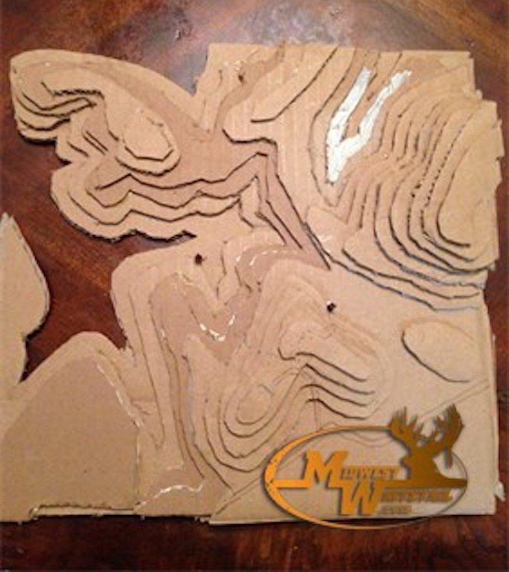
Sometimes, a subject comes along that really catches my eye. Viewer, Wes Chaffin, sent me a photo and description of how he made a scale model of a topo map in order to better visualize what the lines were telling him. It's pretty cool.
I thought you'd get a chuckle from a project I created, Chaffin said. My motivation was that the area I hunt has very dense vegetation with small pines, transitioning into heavy timber. I could look at a topo map all day long and could not get the perspective I needed to adjust my stand location. So, I made my own 3D topo map.

The 3D version revealed a different perspective.
The landowner had me convinced once I move beyond a certain area of the map, I could push the deer out completely, Chaffin said. My pin on the right is the old stand location and one of the left is new. The pin on the right yielded six good deer.
I know this doesn't give you a total perspective to my setup, but it helped gain more insight to my scouting, Chaffin continued. In fact, the enlarged copies are of value as well. I can draw on them. This really helped me a lot. It helped me understand the deer movement in the area.
Don't Miss: A New Place to Consume Midwest Whitetail Content
Check out more stories, videos and educational how-to's from Bill Winke and Midwest Whitetail.


